State officials are urging North Georgia to stay home on Sunday as a potentially large winter storm approaches the area.
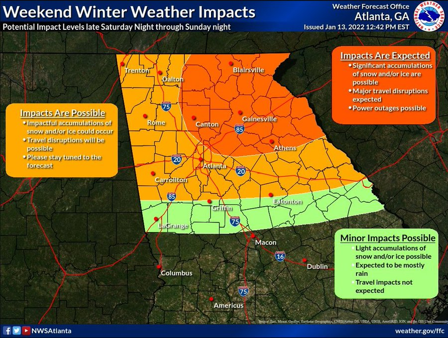
A winter storm watch takes affect Saturday night across Northeast Georgia and areas from Hall County to the northeast may see significant accumulations of snow and ice, as well as the potential for power outages and dangerous travel conditions.
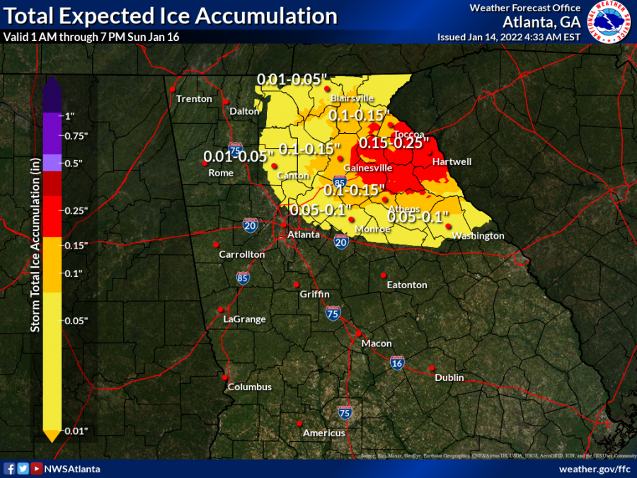
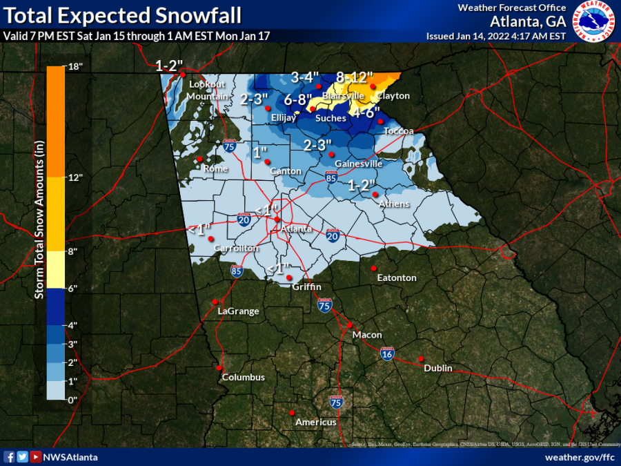
Forecasters said Hall County could see two to three inches of snow and a quarter-inch of ice. Higher elevations in the mountains could see six to 10 inches of snow. Winds could gust up to 35 mph.
Temperatures are currently forecast to be at or below freezing all day Sunday.
Gov. Brian Kemp and other state officials held a news conference this afternoon to discuss what the state is doing to prepare.
"Our main messages is really very simple," Col. Chris Wright of the Georgia Department of Public Safety said. "We encourage everyone to stay off the roadways this weekend if at all possible because you only create a danger for yourself and for your vehicle and other people that might be on the roadway. You also create a danger to first responders that may have to come and try to assist you in some manner."
The Georgia Department of Transportation said it is preparing the storm. Crews are treating interstates and state routes north of a line from Columbus to Jackson to Augusta, Commissioner Russell McMurry said. Tomorrow, he said, crews will double treat the routes.
"Our plan is to double treat the interstates such that we have a barrier that helps delay the onset of ice initially on the interstate highways," he said. "Our highest priorities to hospitals, locations involved in energy generation areas and places such as Georgia Power headquarters and the like."
Once snow and ice start to accumulate, McMurry said the department will switch over to plowing and the spreading of salt and gravel.
According to the National Weather Service, heavy mixed precipitation – snow, sleet and freezing rain – are possible in the watch area. Power outages and tree damage are likely due to heavy snow and ice. The watch begins at 7 p.m. Saturday and runs through 1 a.m. Monday.
As the weather approaches, it is likely multiple weather warnings will be issued.