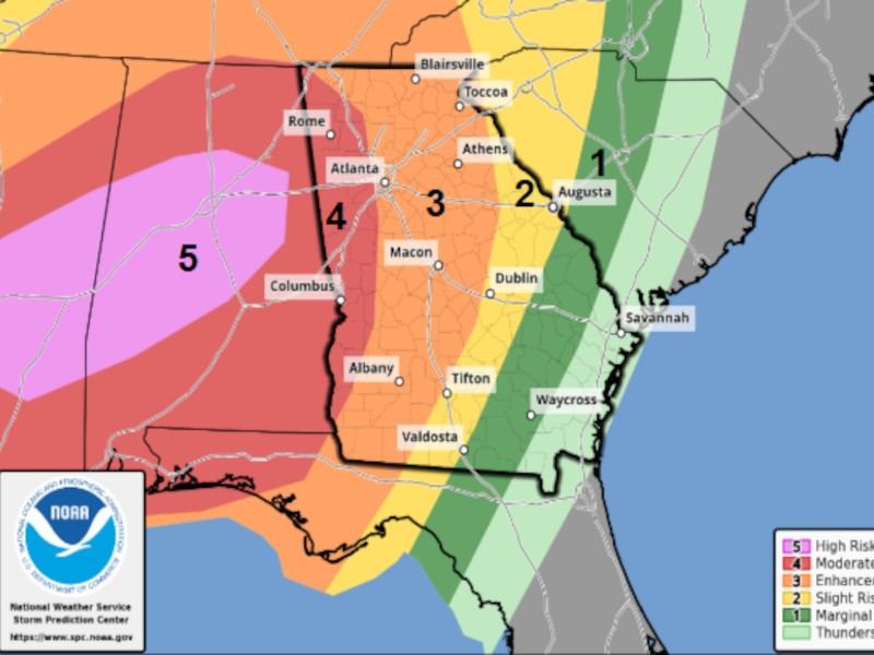
Forecasters are continuing to warn of potential severe weather impacting the Northeast Georgia region Saturday night into Sunday morning, and local officials have been preparing for the potential effects.
National Weather Service Peachtree City Forecaster Keith Stellman said the system that is currently moving through Mississippi and Alabama is expected to reach Northeast Georgia sometime after 9:00 p.m. Saturday.
"Tornadoes, damaging winds, large hail, heavy rain, a lot of lightning, all of that is going to come with these storms that move in overnight," Stellman said.
Georgia Governor Brian Kemp declared a state of emergency for the entire state that will be effective from noon Saturday through 11:59 p.m. Tuesday.
Stellman said the system is expected to move out of the region by around 3:00 a.m. or 4:00 a.m., making it an overnight system. Kemp's statement said that increases the safety risk for Georgians.
"This storm will hit at the worst possible time, as people are heading to or already in bed. Before they retire for the evening, I'm urging everyone to be prepared ahead of time and to remain weather aware as long as this system is in the state," Kemp said. "Given the uncertainty of this storm and the fact it will move through Georgia overnight, individuals and families should prepare now and make plans to stay safe. Just as we've made all necessary preparations on the state level ahead of the system's arrival, Georgians should get ready now and not wait until the storm is already here."
Hall County Emergency Management Agency Director Zach Brackett said it's important for residents to have multiple ways to receive weather notifications should a tornado warning or flash flood warning go into effect.
"Remember that outdoor warning sirens are designed to notify people who are outside to go inside. They're not designed to wake you up while you're asleep inside your home, so that does not count as a notification method," Brackett said.
Brackett advised that Hall County residents can sign up for the county's Citizens Alert System online to receive notifications.
He also said it's important to have a weather preparedness plan in place. That includes having phones fully charged before the storms arrive and having battery-powered flashlights on hand.
"The biggest thing with this is going to be to have a plan of where to go during a (tornado warning,)" Brackett said. "We always recommend going to the lowest level of a structure, into an interior room with no windows."
Local power crews are also preparing for potential impacts from the storms. Wendy Jones with Jackson EMC said their crews are preparing to respond to potential mass power outages if the strong winds and rains bring down large amounts of power lines around the region.
"We have Jackson EMC linemen and our contact center team members standing ready to respond to our members when needed," Jones said. "We will mobilize restoration crews, who will obviously be prepared to respond to any outages as quickly as conditions and safety procedures allow."
Jones said residents should report any downed power lines or power outages to their EMC for the quickest response. She also added that drivers should never try to drive across a downed line.
"If you come upon any fallen line, assume it's electrically charged," Jones said. "That could be cable, it could be TV, it could be telephone, but you never know what it could be wrapped up with, so please be very careful."
To sign up for weather alert text messages from NWS and AccessWDUN click here.