Weather conditions for Monday may not be the best for last day of March in northeast Georgia.
Today's Natioanl Weather Service outlook for the regions indicates that a line of strong to severe storms will move through north and central Georgia this morning through the evening. Additionally, confidence is increasing that another round of showers and storms will develop behind this main line as a cold front pushes through this afternoon and early evening.
The first line of projected storms are expected to bring the following:
-
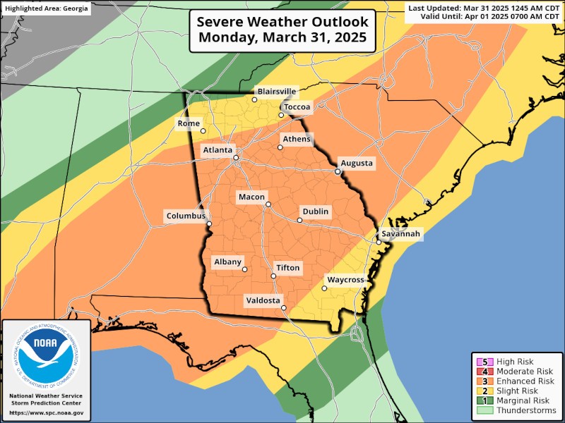
The Storm Prediction Center (SPC) is maintaining an Enhanced Risk (level 3 out of 5) to Slight Risk (level 2 out of 5) for severe weather across much of north and central Georgia.
-
Damaging straight-line wind gusts remain the primary threat, but the potential for brief tornadoes has increased. The hail threat is relatively low. See the SPC graphics below.
-
Potential impacts will be downed trees and powerlines, as well as structural damage.
-
An approximate timeline for the line of storms is as follows:
- Far northwest/far north-central Georgia: 7 AM - 10 AM
- I-85 corridor/metro Atlanta: 10 AM - 4 PM
- Central/east-central Georgia: 1 PM - 6 PM
The final wave of storms could also provide the following:
-
A broken line of showers and storms will likely develop behind the aforementioned main line as a cold front pushes through.
-
A few of these storms could be strong (possibly severe) with damaging wind gusts.
The National Weather Service provides links to stay informed about current weather conditions. Their links are found below:
NWS Peachtree City/Atlanta Decision Support Page