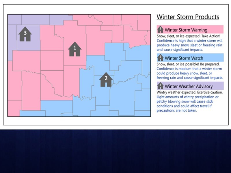
As the weather gets colder, it is important to know the meanings of various winter weather alerts and terminology.
AccessWDUN meteorologist John Wetherbee says the difference between a watch and a warning is the same no matter the condition. A watch means the condition is possible and a warning means the condition is happening or is about to happen. According to the National Weather Service, a winter storm watch alerts the public to the possibility of winter weather, like snow or heavy sleet. A winter storm warning is issued when heavy snow, freezing rain, or sleet is imminent or occurring.
The wind chill is a potential number, meaning it does not really exist, but it helps to know what to expect. It is a combination of the actual air temperature and any air movement. A wind chill warning is issued when wind chill temperatures are “expected to be hazardous to life within several minutes of exposure,” according to the National Weather Service.
“It’s important because even though the temperature may be 30 degrees, if it’s a really gusty wind, it can feel like mid-teens,” Weatherbee said. “And mid-teens has a much quicker impact on the human body.”
The term “snow flurries” explains a situation in which snow is lightly falling for relatively short periods of time. The snow does not accumulate much, if at all. Snow showers occur when snow is falling at varying intensities for brief periods of time. In the case of snow showers, some accumulation is possible.
Sleet refers to raindrops that freeze into ice pellets before reaching the ground. It can accumulate and be dangerous to motorists.
Freezing rain occurs when rain falls onto a surface with a temperature below freezing, causing the rain to freeze and form a coating of ice.
For more information about what to know about winter weather, visit the National Weather Service’s website.


