Updated 1-12-2023 at 6:32 p.m.
Hall County only experienced two impacts to roads after Thursday afternoon's severe thunderstorms rolled through North Georgia.
According to Zach Brackett, Hall County's director of emergency management and homeland security, the tornado watch for the county has been canceled.
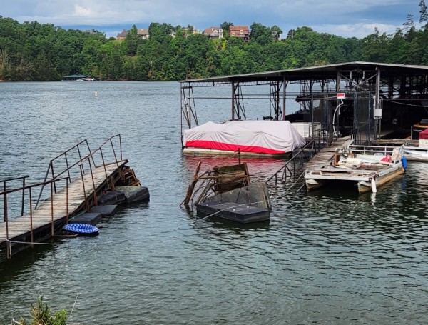
The intersection of Prior Street Northeast and Glenwood, which is in the Martha Hope Cabin area, is currently washed out and will be closed overnight. The City of Gainesville is working to fix this issue.
Additionally, there is one fallen tree in the roadway in the 1900 block of Beechwood Boulevard.
Frances Medows Aquatic Center is also closed for the evening due to a power outage.
Many citizens' power has been restored, but there are still some who are waiting for the lights to flicker back on.
"During the height of the storm there were approximately 780 homes and businesses without power while currently, that number is approximately 100," Brackett said in a press release.
Hall County EMA and Homeland Security said citizens should expect wind gusts up to 30-35 miles per hour and potentially more fallen trees overnight.
Original story posted 1-12-2023 at 11:11 a.m.
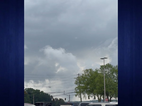
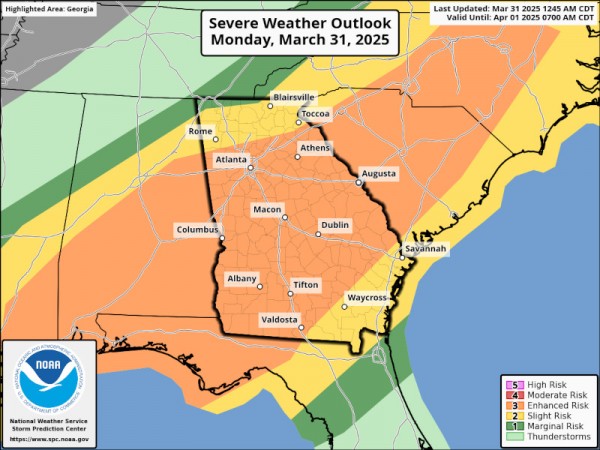
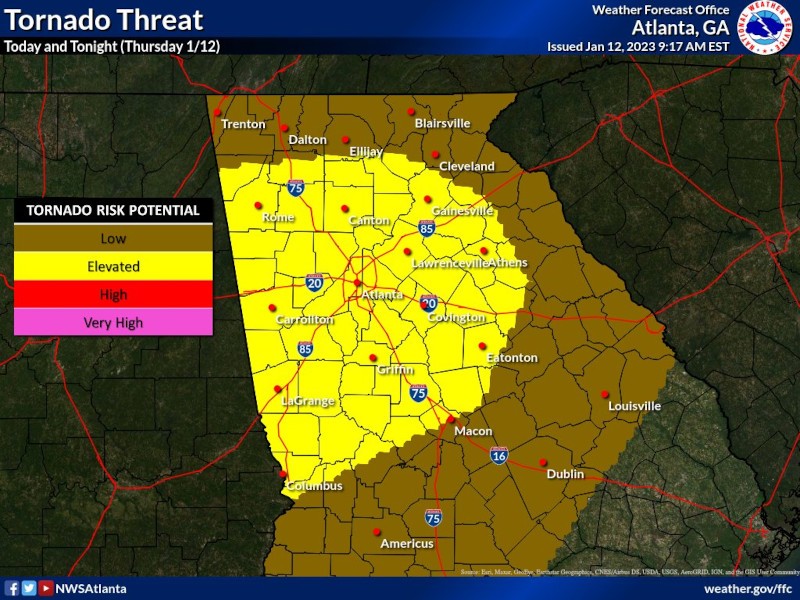
North Georgia is gearing up for strong afternoon storms with high winds and the potential for tornadoes.
Nick Morgan, a meteorologist with the National Weather Service in Peachtree City, said Gainesville and Hall County should experience impacts from the storm between about 3 p.m. and 7 p.m. Thursday.
"The main threats that we're looking out for will be those damaging straight-line winds, the potential for some winds greater than 60 miles per hour along this line," Morgan said. "Some spin-up, brief tornadoes as well, and potential for some one-inch hail."
Morgan said the Gainesville area could experience anywhere from half an inch or up to an inch of precipitation as a result of the storm.
"Once you get into the higher elevations, due to the terrain ... you could see potentials of localized areas [of rain] greater than an inch, but it's not going to be very widespread," Morgan said.
Zach Brackett, director of Hall County Emergency Management, said Hall County citizens should ensure that they have two ways of receiving weather alerts. They can visit this link to sign up for the Hall County Citizen Alert for automatic weather notifications.
"It is important to note that weather sirens are intended for those outside while a storm approaches and not to notify individuals indoors," Brackett said.
Some area school systems have made operational adjustments Thursday to account for the storms, including the following:
- Habersham County Schools - Two-hour early release
- Hall County Schools - All afternoon extracurriculars are canceled, including all practices, competitions and field trips. The district said they do not plan to dismiss school early.