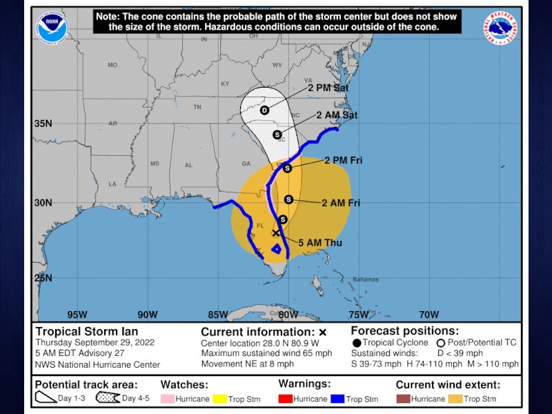
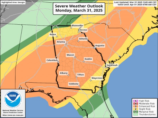
A new projection issued Thursday morning from the National Weather Service showed an eastward shift for Tropical Storm Ian, which may lead to a lesser impact on North Georgia.
The probable path of the storm's center will now head off Florida's Atlantic coast and make an additional landfall in South Carolina at about 2 p.m. Friday. Previous projections showed the storm's center would move directly over the Georgia / South Carolina border. However, Thursday's update leaves Georgia entirely out of the storm's center.
AccessWDUN Meteorologist John Wetherbee said North Georgia will still feel the storm's impacts.
"Ian is so large and the wind field is so big, we will still have gusty winds right into the weekend, and our shower chances and the amount of rain we get will not be as great," Wetherbee said. "But still, wet weather Friday night and Saturday as Ian passes by through South Carolina."
The National Weather Service issued a wind advisory Thursday morning for much of Georgia as the storm makes its way north. The current advisory lasts until 8 p.m. Thursday, but could be extended depending on the impact of Ian. Banks, Barrow, Forsyth, Gwinnett, Hall and Jackson counties are included in the advisory, along with much of the state.
Casey Ramsey, Director of Hall County Emergency Management, said they were actively monitoring the situation and preparing for any needed response.
"Our biggest concern at this point is the forecasted 20-30 MPH wind gusts that are expected to impact Hall County Thursday evening, throughout Friday, and into Saturday morning," Ramsey said. "We encourage citizens to have a plan in place in the event that we experience loss of power as well as down trees which will impact travel. We encourage citizens to monitor a reliable source of news and weather through their local news outlet, the National Weather Service, and local public safety agencies."
Governor Brian Kemp this week declared a state of emergency for all of Georgia's counties ahead of the storm's arrival.


