-
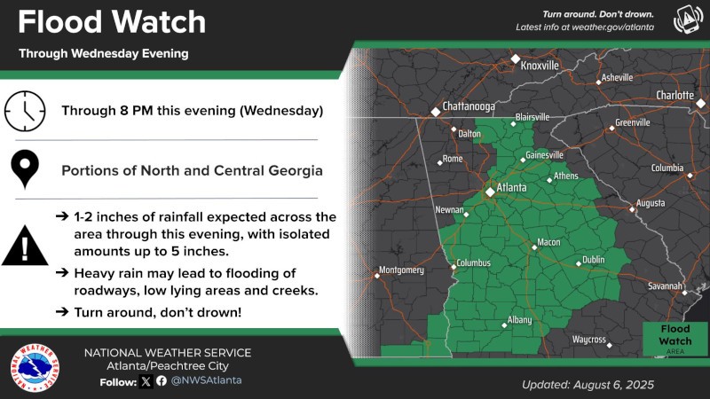
A Flood Watch remains in effect until 8 PM this evening conditional to today's rainfall.
-
A Marginal Risk (Level 1 of 4) for excessive rainfall remains in effect today south and easy of the I-75 corridor.
-
Additional rainfall of 1-2 inches are possible, with isolated pockets of up to 3-5 inches associated with the heaviest rainfall.
-
Areas within the Flood Watch are primed for flooding conditions. These areas have already received 1-2 inches of rainfall over the past 24-hours and widespread 2-4 inches of rainfall over the past 48 hours.
-
Heavy rain during a short amount of time could result in flooded roadways especially in areas with poor drainage.
-
Saturated soils could result in quicker flash flooding conditions should rain persist (train) over the same area(s).
-
Any thunderstorms that produce gusty winds, even winds 25-30 MPH, could result in downed trees due to saturated soils
You can find more information through the NWS Point Forecast Page.