Summer swealtering heat conditions are back for another day of concerns in parts of central and northern Georgia counties.
The National Weather Service has issued a formal Heat Advisory for much of the Metro Atlanta area, while including areas just east of Gainesville. Counties included in the officials advisory include Banks, Barrow, Clarke, Jackson and Madison Counties.
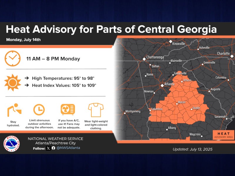
Temperatures are expected to reach the mid-90's for most of Georgia on Monday, prompting the Heat Advisory between 11:00 a.m. and 8:00 p.m. The official statement from the National Weather Service out of Peachtree City includes the following:
- Heat Advisory issued for portions of east and central Georgia on Monday.
- Heat index values up to 109° within the Advisory area.
- Across north Georgia and in areas like the Atlanta Metro, heat indices of 99° to 104° are expected. You'll need to head up in elevation to escape the upper 90s or triple digit heat indices.
- Isolated to scattered thunderstorms will occur again Monday afternoon (very low severe risk). Best chances of a storm will be across northern and east central Georgia (30-40%).
- The hottest temperatures will occur in the Advisory area between 11 AM and 8 PM on Monday.
- Additional Heat Advisories may be issued for portions of central Georgia for Tuesday, but uncertainty is high.
- High confidence heat index values reaching above 105° across large portions of the advisory area.
The National Weather Service provides links for following the details that lead to their Heat Advisory and other watches throughout Georgia:
NWS Peachtree City/Atlanta Decision Support Page