Rainfall that started in North Georgia Wednesday evening has become progressively worse throughout the day Thursday, spawning tornado warnings and causing flooding across the region. As a result of the continued rain, several counties have announced road closures.
Hall County
As of late Thursday night, the following Hall County roads were closed:
As of late Thursday night, the following Hall County roads were closed:
- Lawson Road in the northern end of the county
- Calvary Church Road has been closed between Poplar Springs Church Road and Poplar Springs Road
- Belton Bridge Road is closed in the area of Pea Ridge Road
- Bryant Quarter Road is closed between Cain and Buffington roads
Banks County
Banks County has a number of secondary roads closed due to flooding, according to EMA Director Deidra Moore.
Blue Ridge
University of North Georgia's Blue Ridge campus delayed opening Friday morning until 10 a.m.
Forsyth County
Oak Grove Circle near Squattingdown Creek will be closed until further notice because of erosion caused by Thursday's floods.
Oak Grove Circle near Squattingdown Creek will be closed until further notice because of erosion caused by Thursday's floods.
Franklin County
Franklin County schools will be operating on a two-hour delay Friday morning.
City of Jefferson
Hill Street closed at Mahaffey Street because of a sink-hole.
Lumpkin County
Lumpkin County schools operating on a two-hour delay Friday morning.
Rabun County
Rabun County schools will be operating on a two-hour delay Friday morning.
Stephens County
Stephens County has received reports of flooded roadways caused mostly by clogged drains and ditches, said EMA Director Danielle Rhodes.
White County
White County Public Safety Director David Murphy said problems began developing around 6 a.m. all over the county.
- Multiple trees reported down across the county.
- Three reported residential fires from lightning strikes, with no major damage on two of those structures.
As of 5 p.m. Thursday, the following roads in White County were closed:
- Charlie Thomas Rd @ Bridge
- Sandy Flats Rd from Far Winds Rd to Lumpkin County Line
- Bottoms Rd off SR17
- Lynch Mountain Rd from House# 234 to Bridge
- Roy Powers Rd near Bridge
Despite tornado warnings popping up in a number of North Georgia counties since early morning, emergency officials have reported no injuries resulting from the storms.
Rainfall totals could reach anywhere from 2 to 6 inches before the system moves out of the area Friday morning, according to the National Weather Services.
The heavy rain prompted Gilmer County and Union County Schools to close early Thursday.
Some prep basketball tournaments have been postponed because of dangerous driving conditions.
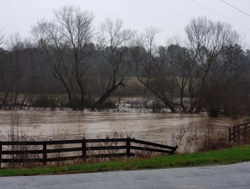
Flood waters in a low-lying field on Jim Hood Road in North Hall County approach the roadway around mid-morning Thursday. (Photo: Philip McQueen)
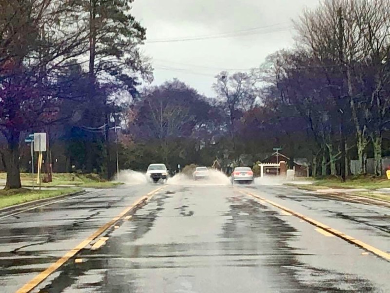
Vehicles splash through standing water in the roadway in the Royston area. (Photo: Royston Police Department)
Habersham County EMC was responding to a power outage Thursday morning in an area of US 129 when crews spotted this blown transformer on a power pole.
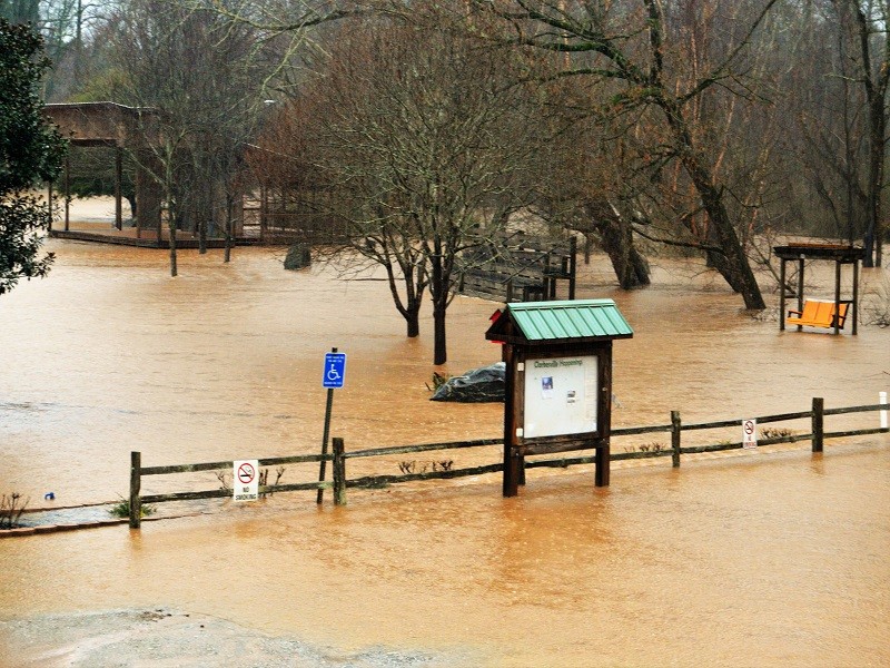
Floodwaters cover Pitts Park in Clarkesville. (Photo: Rob Moore)
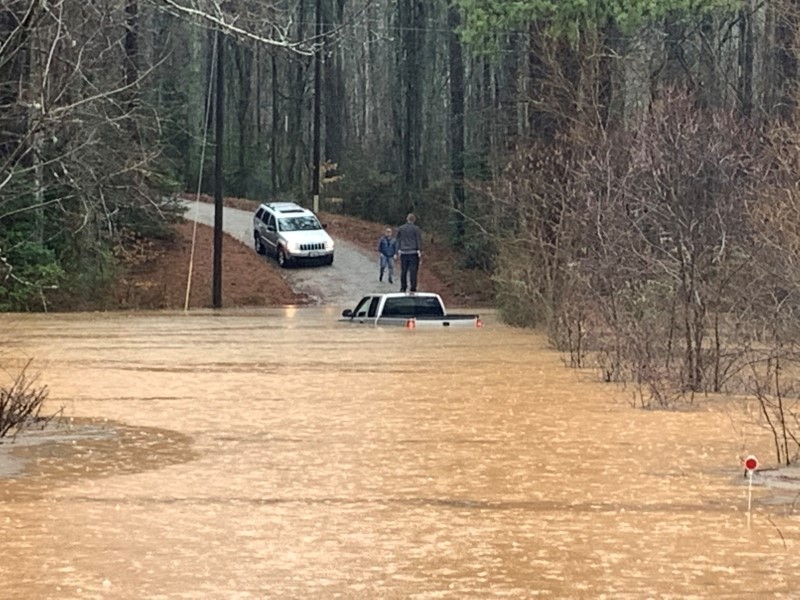
A man who tried to drive across a flooded road in Hollywood in north Habersham County is stranded on top of his truck. His neighbor had to rescue him. Habersham County Emergency Services Director Chad Black warned motorists to never attempt to cross a flooded roadway. (Photo: Habersham County Emergency Services)
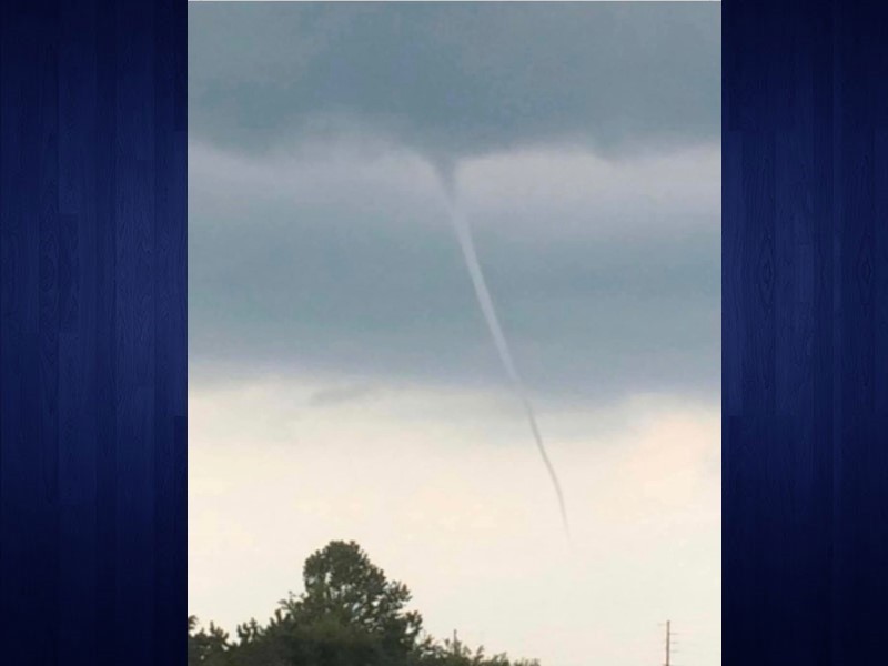
Tornado warnings popped up across North Georgia Thursday morning. This funnel cloud was seen in the sky over Watkinsville. So far, no touchdowns have been reported. (Photo submitted: Anthony Dye)
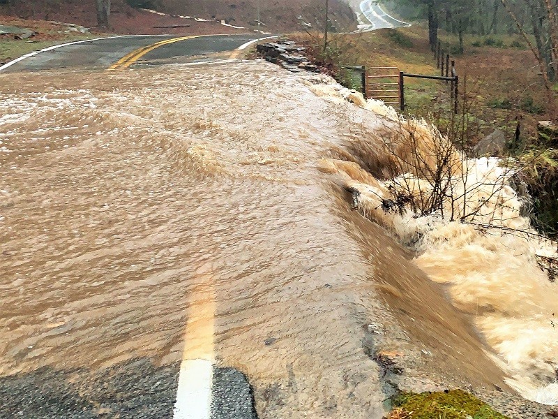
Water rushes through The Dip on Ga. 197 North in Batesville. (Photo: Brittany Perry)
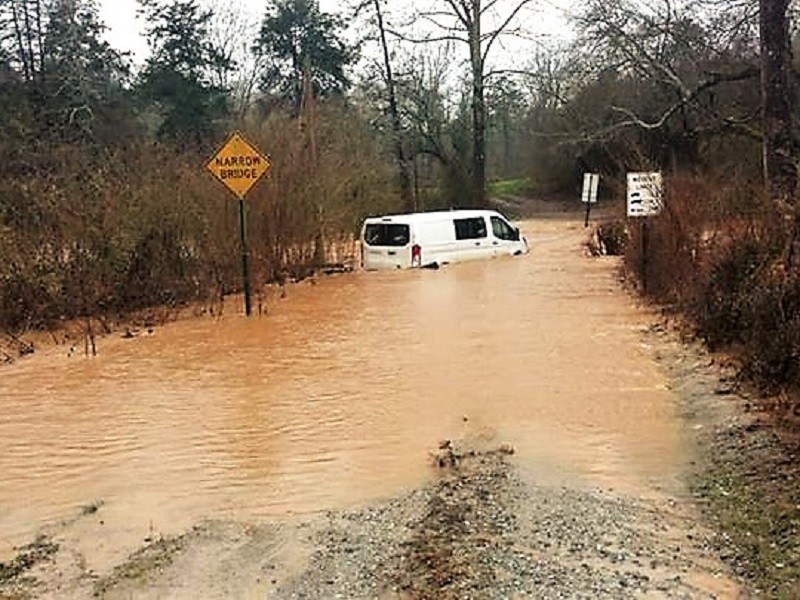
Habersham County Emergency Services personnel responded to an Amazon delivery van that was swept sideways on Garrison Drive off Garrison Road Thursday afternoon. (Photo: Hulsey Towing)
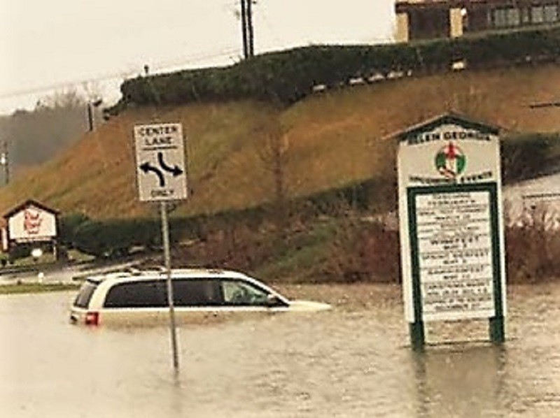
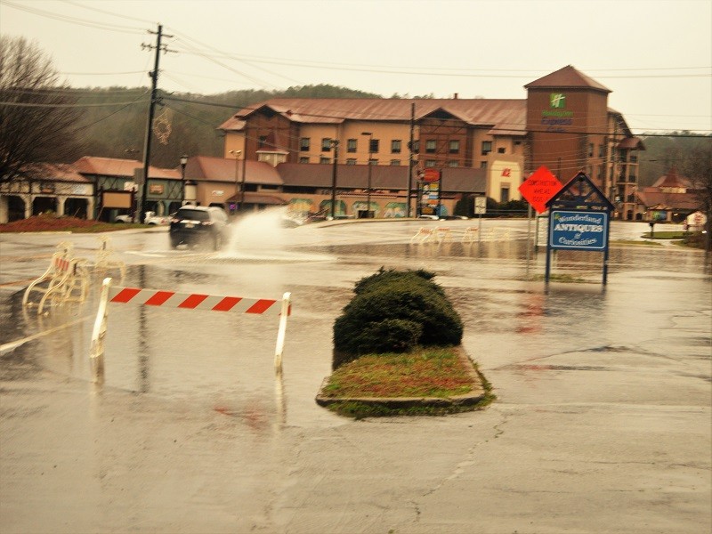
Water rises on a van stranded in the flooded parking lot of a convenience store on South Main Street in Helen.
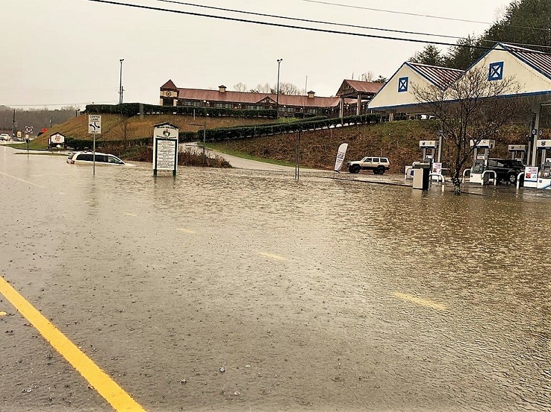
Water rises on a van that attempted to access the parking lot of a flooded convenience store on South Main Street in Helen.
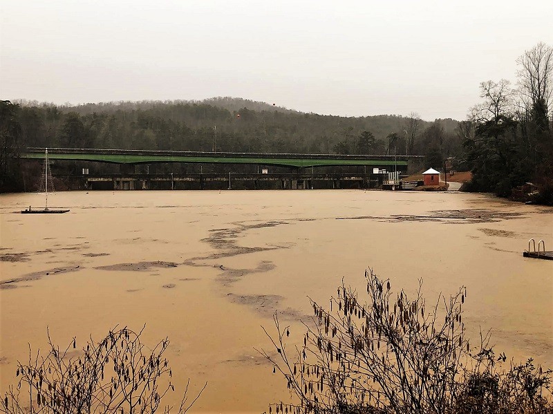
Debris fills the swollen Tallulah Lake in Tallulah Falls. (Photo: Tallulah Falls Police Department)
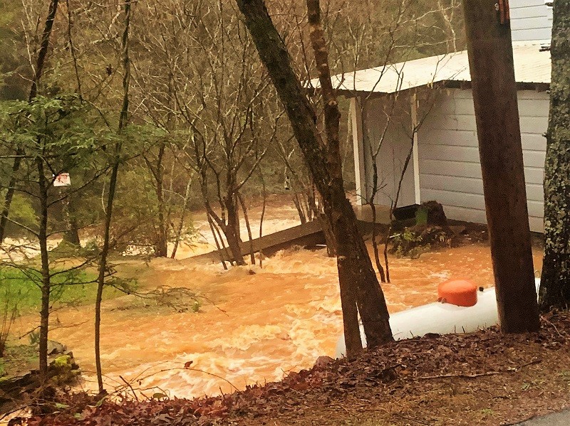
Water fills the yard of Mark of the Potter on Ga. 197 in Batesville. (Photo: Brittany Perry)
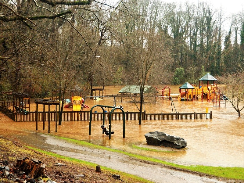
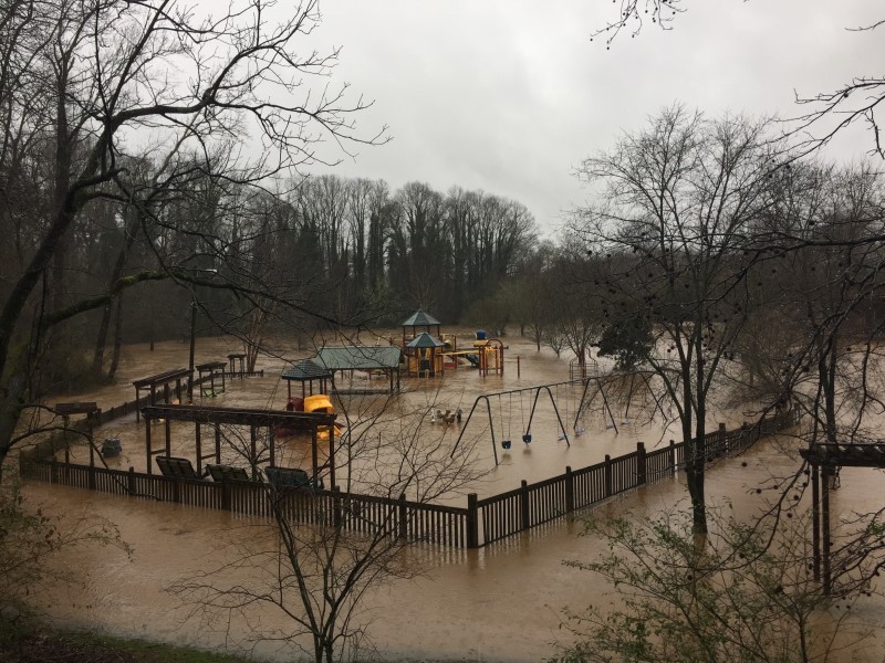
Floodwaters cover the playground at Pitts Park in Clarkesville, which remains closed until further notice. (Photo: Rob Moore)
Soon after new swings were placed in Pitts Park in Clarkesville, the waters of the Soque River again have spilled into the park. (Photo: Rob Moore)
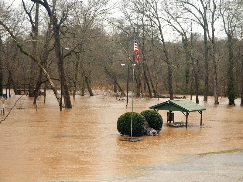
The waters of the Soque River spill into Pitts Park in Clarkesville. (Photo: Rob Moore)
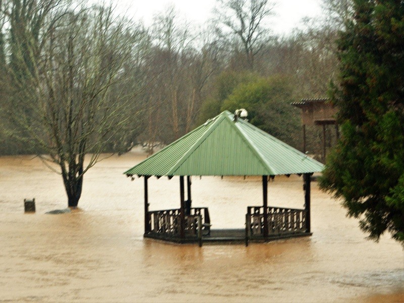
Water from the rain-swollen Soque River fills Pitts Park in Clarkesville, making the gazebo an island. (Photo: Rob Moore)
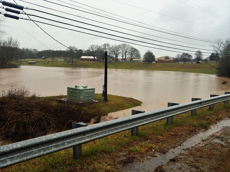
Beaver Dam Creek at Clarkesville Elementary covers the lower level of campus. (Photo: Rob Moore)
A vehicle splashes through the standing water on South Main Street in Helen Thursday afternoon. (Photo: Rob Moore)
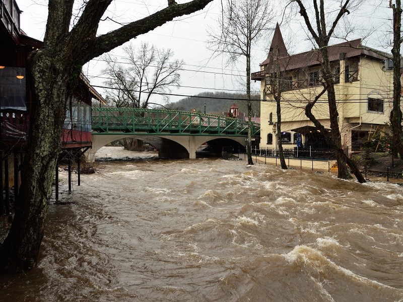
The Chattahoochee River roars through downtown Helen Thursday afternoon. (Photo: Rob Moore)
Waves pound the banks of the Chattahoochee River in downtown Helen Thursday afternoon. (Photo: Rob Moore)
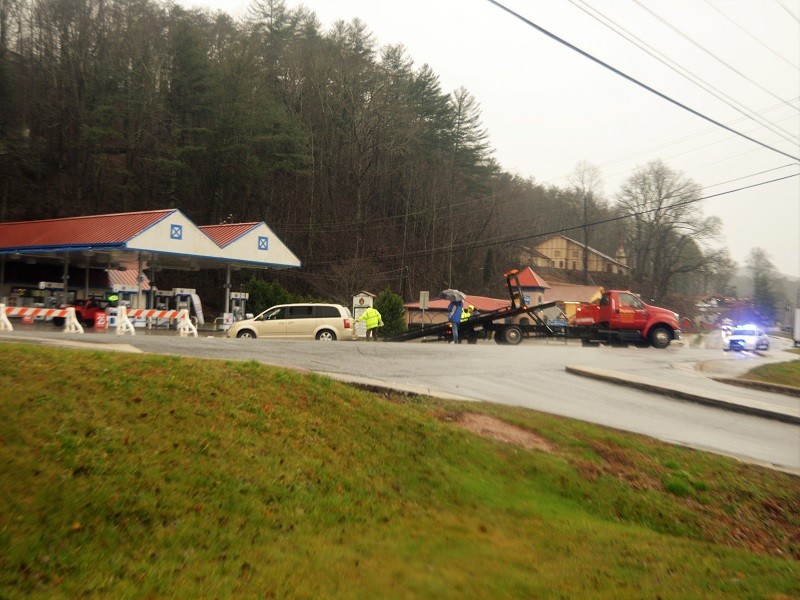
Towing operators prepare to load a van after removing it from the flooded parking lot of a convenience store on South Main Street in Helen. One lane of South Main Street (Ga. 75) remained closed most of Thursday. (Photo: Rob Moore)
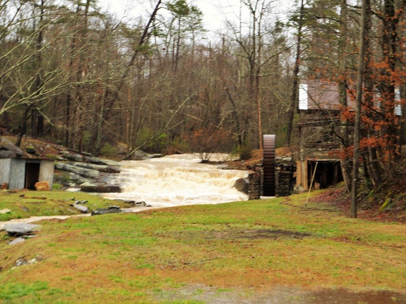
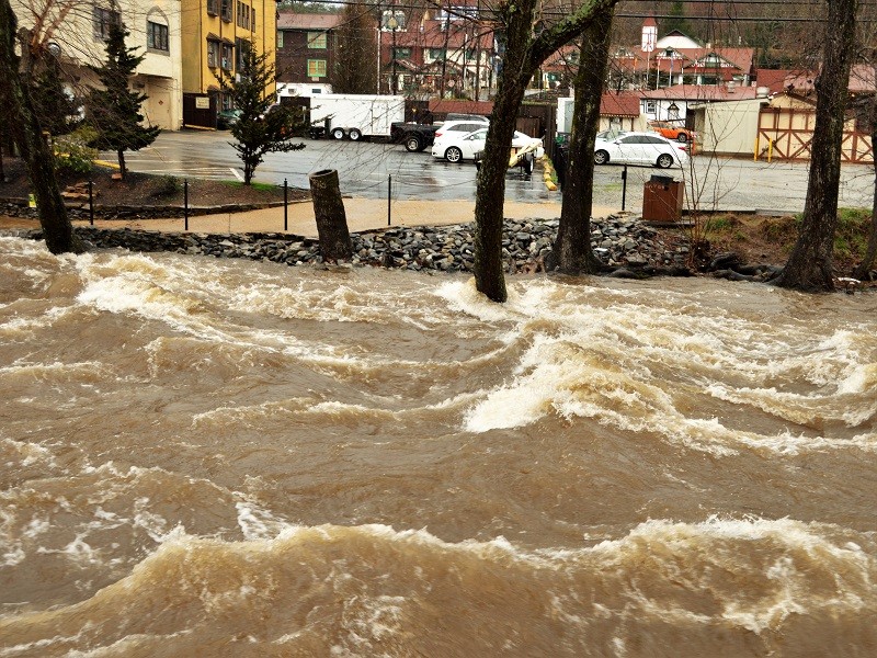
The rushing waters of Hazel Creek roar past Hazel Creek Mill. (Photo: Rob Moore)
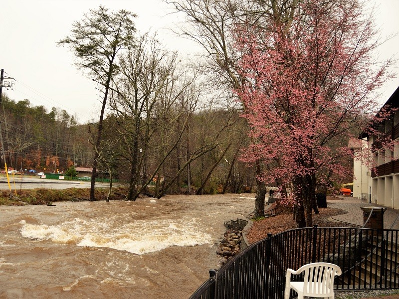
The Chattahoochee River rushes past The Helendorf River Inn in Helen. (Photo: Rob Moore)
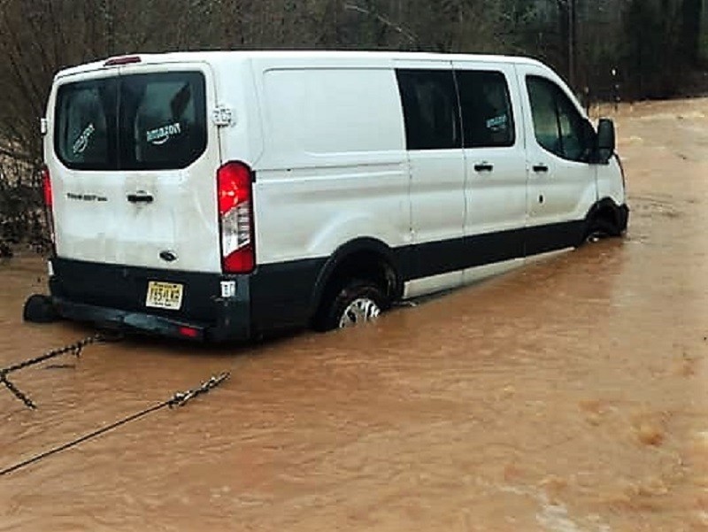
Hulsey Towing personnel recover an Amazon delivery van from a flooded road outside Cornelia Thursday afternoon.
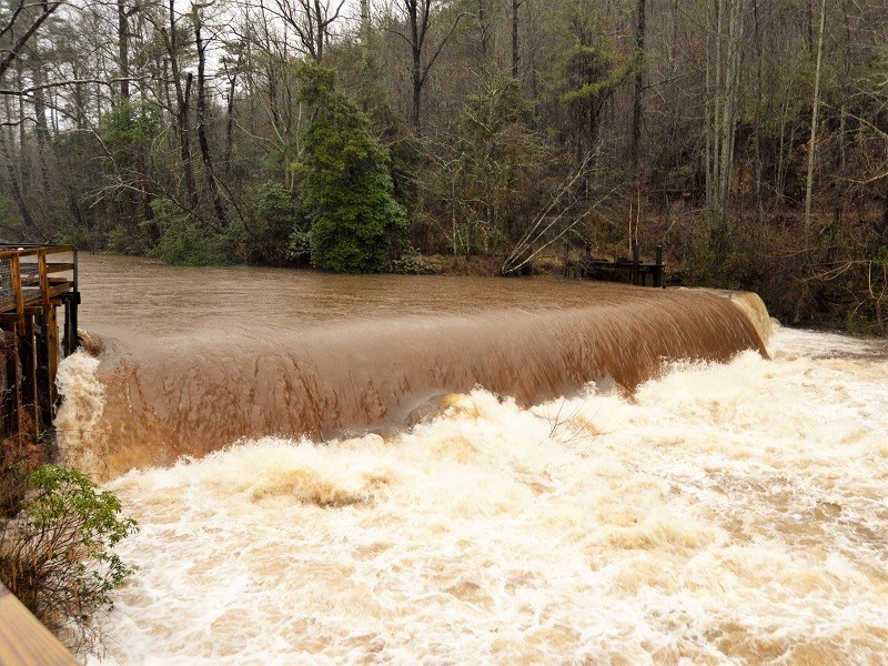
The Chattahoochee River rushes past Nora Mill outside Helen Thursday afternoon. (Photo: Rob Moore)
http://accesswdun.com/article/2020/2/874505/storm-system-prompts-tornado-warnings-dumps-heavy-rain-on-north-georgia