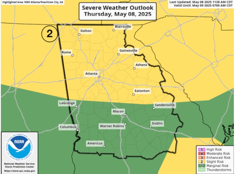
The National Weather Service has expanded its risk area for severe weather Thursday evening.
A release from the NWS Peachtree City office Thursday afternoon now includes all of North Georgia and Middle Georgia in its "slight risk" range for the storms.
"Scattered thunderstorms are expected to push into north Georgia this evening into the overnight time period," the weather service said. "These storms are expected to become severe with large hail (up to 2 inches) and damaging wind gusts being the main threat."
The weather service said tornadoes are not expected to be a significant risk with the storm system, but said that heavy rain is expected to continue through the following days, potentially leading to flooding risks by Tuesday, May 13.
The Thursday storms are expected to enter the region between 6:00 p.m. and pass through by 1:00 a.m. Friday, May 9.
http://accesswdun.com/article/2025/5/1291014/national-weather-service-expands-risk-potential-for-severe-weather-thursday-night