If you’ve been around North Georgia awhile, then you already know gold was discovered in 1828 in Dahlonega. One “glory hole,” or large vein of gold, caught some particular attention and in 1895 that area became the Dahlonega Consolidated Gold Mine. It was said to be the first attempt at deep, systematic underground mining in the east and became something of a legend.
The gold mine no longer operates as it used to, of course, but it still attracts tons of visitors every year. The mine is constantly trying to find ways to ensure it is safe for guests to enjoy, and now they are working on a project to even expand tours deeper into the mine. That not only means making sure those new areas are safe, but it also means going where no one has stepped foot for nearly a hundred years.
What’s the best way to do that? A drone, of course. So Consolidated Gold Mines recently hired a drone company, Inspired Intelligence, to help them figure out what all is really there, in the deepest, and darkest places, under the ground.
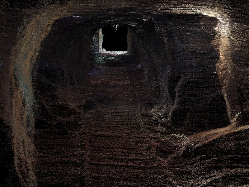
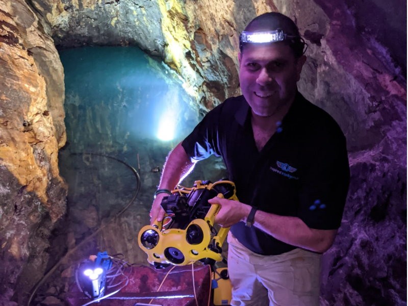
Nir Pe’er is the CEO and Founder of Inspired Intelligence and said it was an incredible experience taking his equipment underground. “In this project we were actually doing something amazing for the first time. We were able to go into Consolidated Gold Mine and actually start a unique project with flying drones underground, using LiDAR Equipment, which is laser scanning, to be able to produce a 3D map of the mine.”
The goal of Inspired Intelligence was to collect the data to give to the mine owners, who will then use it to determine how, if and where to move forward on their goals of opening up new areas to the public.
Most of the mine has otherwise been completely inaccessible up until this point. Entire sections of tunnels have not been entered for many years, not only for fear of safety, but some areas are completely underwater, so no one knows what is truly down there. Until now.
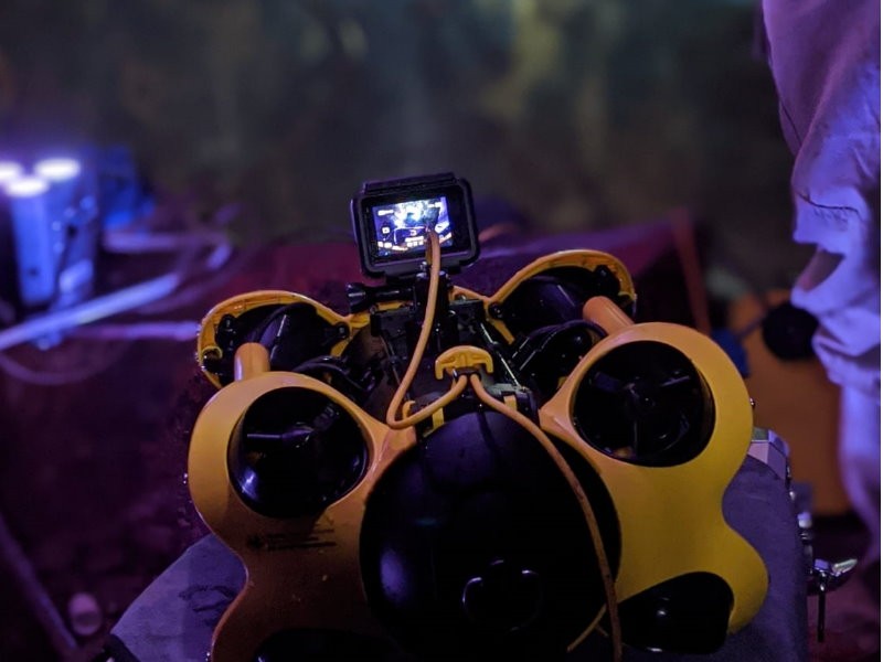
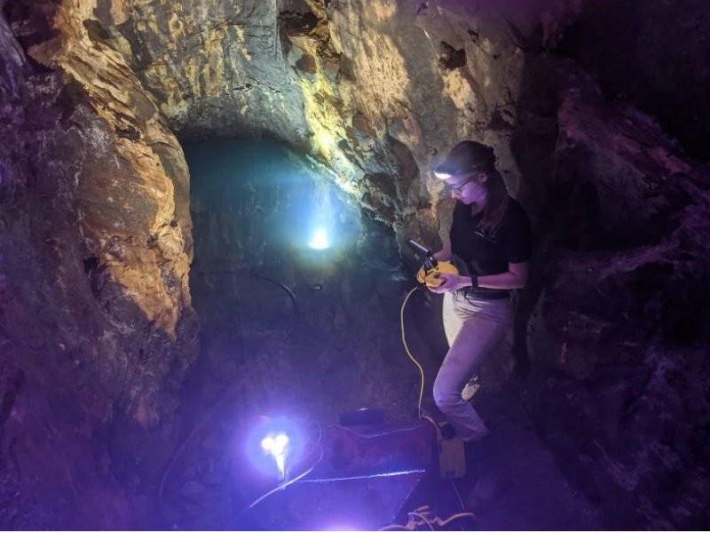
“There is not a lot of information about these areas and that’s where we came into play,” says Pe’er. “During the project, which was an amazing journey for us and the mine, we came across sections that are completely underwater. We were able to use our underwater drones and send them inside to bring back amazing high definition quality videos and pictures from these sections to give us information, that actually was known, until now, only from the miners journals and old newspapers. That was the only sources that we could get information about the mines. But then, for the first time, we were able to put eyes inside the mine with drones, even going underwater, to bring back all this amazing data.”
The drones were able to capture enough data to create 3D models, including measurements and distances, of the mine. They were able to develop a detailed blueprint of the mine both underground, as well as all of the buildings and area above ground. Pe’er says it was not his job to make the decisions on the outcome of the project, but to simply provide the data, which they were able to do in the most incredible way. “We did this project together and actually were able to bring data and record history for the first time in areas that nobody has been in for generations and even a century. And we were able to go into these areas and bring back data that was, before now, completely unknown.”
Not only was this the safest option, but it also was the best way to preserve the history, and required little risk. Due to the inaccessibility, no one has explored the area because they don’t know exactly how safe it is. “Our technology was able to scan everything in the accessible areas and we basically didn’t have to risk any lives or risk injury, but we were able to provide the tools to bring back amazing data that the mine can actually use,” adds Pe’er.
In fact, the data is so detailed that first responders could use it as a map they could access online if there was ever an emergency underground. The data was very specific, including the types of rocks that are in the areas explored by the drones. The scanning equipment was able to go so far as to determine if it was hard rock or soft rock that was encountered, giving a clearer picture on the safety of that area.
Not only was the project enlightening for the mine, but also for the drone operators, who had never before used their equipment underground, and in such a challenging environment. “It was definitely a one-of-a-kind project,” says Pe’er. “Obviously a lot of work around the US was done underneath the ground. And this was groundbreaking when we used drones underground to fly inaccessible areas and scan the mine underground and above, and not only that, but also go underwater with underwater drones and bring back videos. That was incredible.”
While it presented some challenges from an equipment standpoint, Pe’er said he was impressed with the abilities of the drones, and his team. “To be honest, we were stretching the limits of our equipment. It was amazing to see how we could resolve all the challenges that we had with the equipment. We had to scan a certain way. It was amazing to see that we actually managed to figure it out and get great data.”
Pe’er says it was an amazing project for his team and he enjoyed the experience immensely. “I really enjoyed working with the amazing people of Consolidated Gold mine. It was a great journey. On a personal level, I REALLY enjoyed the challenge of working with technology underground in such a harsh environment. We were able to actually test our equipment and stretch the limits. And take a leap of faith that we can do this project. And use this amazing technology.”
And it is amazing. As today’s technology gets even more futuristic, it is quite incredible to see where future and past collide – in this case inside the tunnel of a North Georgia mine. For more on Consolidated Gold mine, go to consolidatedgoldmine.com. For more on Inspired Intelligence, visit iidronesusa.com.


http://accesswdun.com/article/2020/9/941123/drone-technology-uncovers-the-history-of-a-north-georgia-mine
