GAINESVILLE – Managing something as enormous and vital as Lake Lanier can be overwhelming. The management plan used by the U.S. Army Corps of Engineers since the 39,000-acre reservoir reached full pool 62-years ago is dynamic out of necessity.
The policies and priorities that were critical yesterday aren’t necessarily critical today.
In October, 2017, the Corps said in a media release that public meetings would be held in Buford, Gainesville, Cumming and Dawsonville "to review current and future recreational needs and capacity at Lake Sidney Lanier."
Revisions to The Lake Sydney Lanier Master Plan were needed.
Those meetings occurred in early 2018 and hundreds of area residents offered input. Their comments, suggestions and criticism was considered and cataloged under headings such as safety education, erosion and sediment control, facilities, crowding and conflict, and hunting and wildlife development, et al.
Now, two years later, Corps leadership, along with their chosen expert subcontractors, return to the four above-mentioned cities with proposed management actions based on the feedback received in 2018.
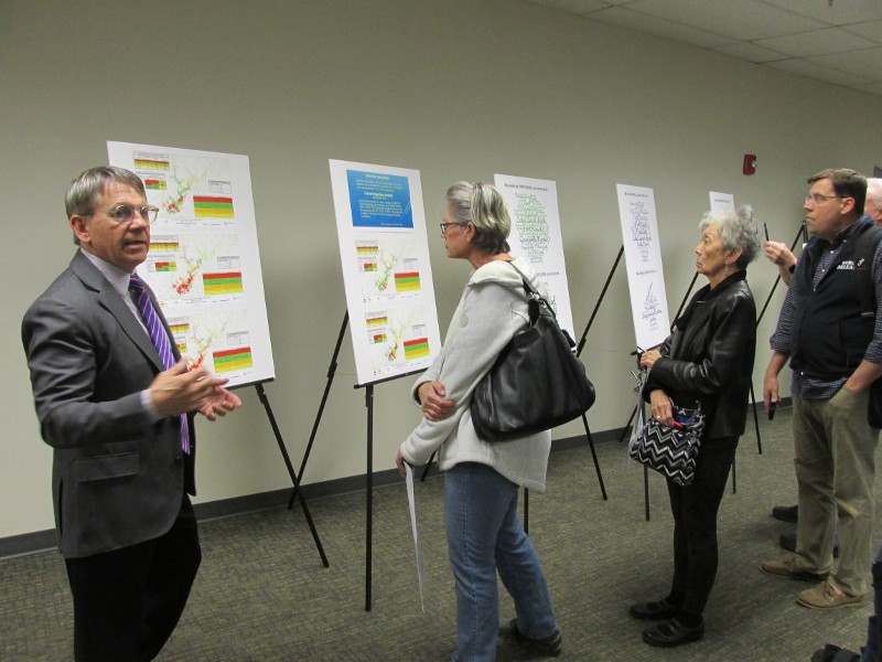
The Hall County Government Center hosted the Gainesville drop-in meeting Tuesday evening. Roughly 100 people showed up to hear the proposed actions and offer additional comment.
“This is all part of the same Master Plan study,” Park Ranger John Matlock explained as he welcomed attendees. “It started two years ago with…stakeholder input. The data that they collected at those is what made the basis for the proposed actions they are talking about now. This is going to be feedback on top of the input that we got two years ago.”
John Titre, principal with Boating Capacity Solutions and the contractor hired by the Corps for this project, was the first exhibitor encountered upon entering the meeting room. He said, “We have really come to see what is important to those who love Lake Lanier, but the process of gathering information is not over and we hope to hear from a lot of people tonight.”
Titre had on display a series of charts and graphs projecting scenarios that Lake Lanier might experience if visitation, as well as immediate area population growth and development, continue to rise as they have. “We don’t want Lanier to experience some of the problems other lakes have encountered that grew without control, such as Lake of the Ozarks.”
Park Ranger Russ Lundstrum’s exhibit drew the biggest crowd. He was using an overhead monitor to show an aerial map to explain proposed development plans for Corps recreational properties.
Lundstrum also had a massive three-ring binder with him that contained plates for each of the 301 USACE-owned recreational sites on and around the lake. He said a little under half of the sites were currently in use but plans to possibly develope another 75 were under consideration as part of the Revised Master Plan.
But Lundstrum was quick to point out that current funding was extremely limited and did not support opening new sites unless private funding could be incorporated. “The Corps doesn’t have the budget right now to build and maintain additional parks.”
“But some of that land is being used right now (without official permission or sanction) and trails are being built that aren’t sustainable…so let’s work with the homeowners to build something that is sustainable,” Lundstrum said.
Lundstrum openly extended an invitation to homeowner associations adjacent to Corps property, as well as other civic organizations, to contact him through the Buford USACE Office and he’d be happy to discuss a mutual arrangement to sustainably develop those Corps properties.
An exit interview with several attendees showed strong favor for the interactive website with satellite-based maps created by the Corps. “I plan to spend some time learning what future parks and stuff like that might be coming up, and to learn more about the lake,” said one lakeside resident who didn’t want to be identified.
But not everyone was totally happy with the proposed Master Plan. Donna Kotsay and Michael Fairclough are neighbors and if the proposed Davis Bridge Park is opened it will surround their homes on three sides, something Fairclough doesn’t want.
Fairclough said, “The only area on Lake Lanier where the shoreline is designated ‘Recreation Only’, where homes are surrounded by the recreation area, is this one. With the proposed hiking trails we would have people walking less than fifty feet from windows in our house.”
“Our concern is what we see at (nearby) Robinson Park when we go to walk the trails there: the liquor bottles, the broken car windows with boat trailers behind them, the used condoms in the parking lot, the empty drug baggies that are all over the place there.”
“If they can’t manage the existing properties, why would they increase the responsibility that they have for management?” Fairclough added.
Scott Lippman has lived on the shore of Lake Lanier since 1995 and spoke with several Corps representatives Tuesday evening. Afterwards, Lippman said he felt that those he spoke with had genuine interest in the things that concerned him, but, “I just think that they are like a lot of government agencies: understaffed and underpaid.”
The interactive website mentioned above and Corp property map is available by clicking here.
http://accesswdun.com/article/2020/2/879912/lake-lanier-master-plan-update-team-visits-gainesville