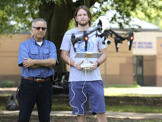
For his final project before retirement, JB Sharma assembled a team of University of North Georgia faculty, staff and students to aid his cutting-edge research on drone mapping.
The products are twofold: a detailed digital elevation model and multispectral image mosaic of UNG's Gainesville Campus and a book that will serve as the industry standard for map work with small drones.
Sharma, who retired as assistant head of UNG's physics department May 31, is the editor of the book "Applications of Small Unmanned Aircraft Systems: Best Practices and Case Studies" set to release in fall 2019. He additionally wrote a chapter with his UNG collaborators: alumnus Payton Duran, staff member Lance Hundt, and faculty member Zac Miller. The four authored the chapter titled "2D and 3D Models with sUAS Based Multispectral and Thermal Imaging — The Campus as a High Spatial Resolution Mapping Laboratory."
Duran, who graduated in December 2018, called it a learning experience. He is excited that efforts like these will help people hear about and see environmental changes.
"It's a great opportunity to be able to convey information better," Duran said.
The other 11 chapters are written by leaders in the world of drone technology. The book, which will include authors from Georgia Tech, the University of Georgia, Virginia Tech, University of Arkansas, Czech Academy of Sciences, and University of Basilicata, will be published by Taylor & Francis Group.
"It will help people construct curriculum to train people in the mapping sciences," Sharma said.
The drone industry will be worth $82 billion and account for 100,000 new jobs by 2025, according to the Association for Unmanned Vehicle Systems International.
Sharma's efforts received financial support through his role as UNG Eminent Scholar for Teaching and Learning, which is funded by the UNG Foundation, and the national remote sensing consortium AmericaView.
Sharma's work focuses on small, unmanned aircraft systems, the designation for drones that are between half a pound and 55 pounds. The implications of Sharma's research for UNG's campuses could be vast.
Sharma noted the images of the Gainesville Campus show different types of trees and represent a historical record that can be used as a reference if a pest infestation or storm changes the landscape. The images are so detailed they were used in the Digital Fabrication Laboratory on UNG's Gainesville Campus to print a 3D model of the Martha T. Nesbitt Academic Building.
In the future, Sharma said the thermal map capabilities could let UNG compare campus buildings' energy efficiency. He also sees students going on a "digital" field trip to Hurricane Creek Field Research in Dahlonega to prepare for when they are actually at the site.
Hundt, information technology systems manager at UNG, was Sharma's student in the mid-2000s. He assisted Sharma's data collection by providing cloud computing through Microsoft Azure. Hundt said data processing that previously took days was reduced to hours once Sharma accessed the cloud computing resources.
Years after being Sharma's student, Hundt was grateful to play a role in Sharma's final pre-retirement project.
"He just inspires you when you're around him," he said. "It's cool to pay him back by collaborating on this project because he's been a big influence in my life, in my career."
Hundt also sees the cloud computing as a possible tool for other faculty members' research.
Miller, a senior lecturer in UNG's Lewis F. Rogers Institute for Environmental and Spatial Analysis who has worked with Sharma on the project, appreciates Sharma's collaborative approach and the experience gained by students.
"The students are excited to work on it," Miller said. "And it's something that's going to help them when they go into this field."
Sharma hopes to expand his detailed maps to include UNG's Dahlonega Campus.
http://accesswdun.com/article/2019/8/818751/university-of-north-georgia-gainesville-campus-subject-of-drone-mapping-research