The first of three anticipated rounds of rain and thunderstorms is inching its way across North Georgia, flooding roads, parks and other properties in the region.
The National Weather Service in Peachtree City has issued flood warnings for most creeks and rivers from Atlanta to Suwanee to Chatsworth - basically all of the northern and central parts of the state. A flood watch remains in effect for north and central Georgia through Saturday morning. A second rounds of storms is expected to dump more rain across the region starting Saturday evening. A third round is forecast for early next week.
Road closures have been reported in several counties as water pours over creek and river banks into roadways. Please be aware that flood conditions can change quickly; law enforcement advises that you never drive across a flooded roadway, since the roadbed underneath the water might be washed away.
We're sharing some photos here from around the region. You're welcome to submit photos to [email protected], and we will include them in our photo gallery as we have time to do so.
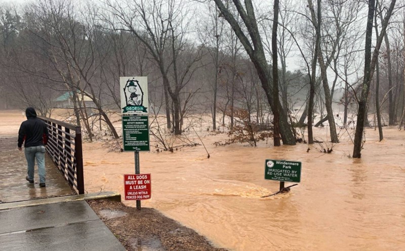
Forsyth County Parks & Recreation officials closed Windermere Park because of flood conditions. (Photo: Forsyth County Government Facebook)
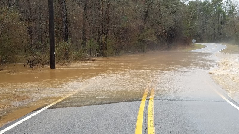
Belton Bridge Road in the East Hall area was closed Friday afternoon after flood waters covered a portion of the road. (Photo: Phillip Anderson)
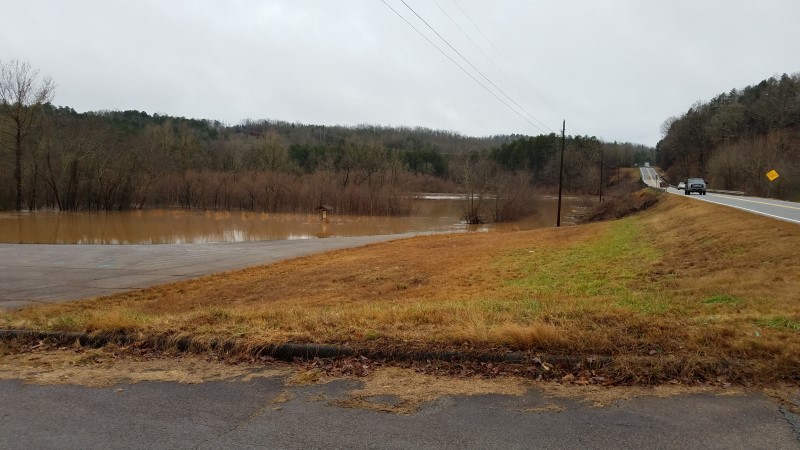
Water from Lake Lanier creeps into the parking lot at Lula Park on Highway 52. (Photo: Phillip Anderson)
Floodwaters cover a street behind Burger King in Cleveland. (Photo: WRWH)
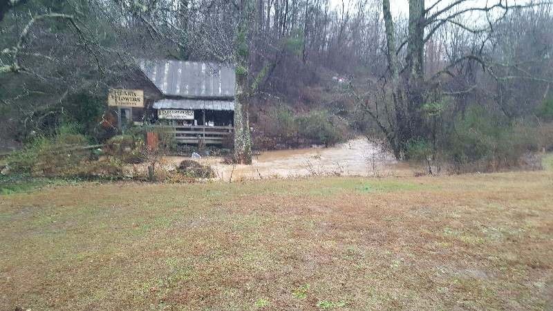
Water rises in the creek next to the Hearts & Flowers Gift Shop on Hwy. 115 in Cleveland. (Photo: WRWH)
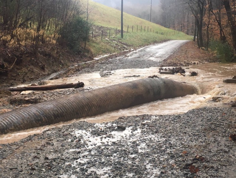
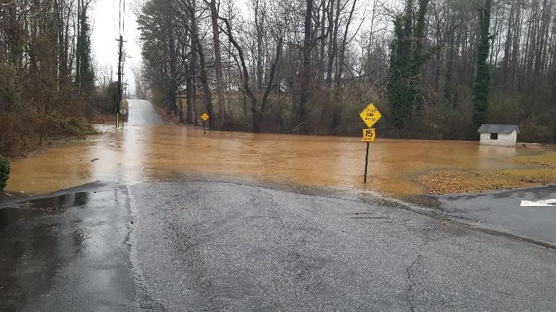
A portion of Wahoo Creek Road in Lumpkin County is washed out by Friday's heavy rains. (Photo: Lumpkin County Government Facebook)
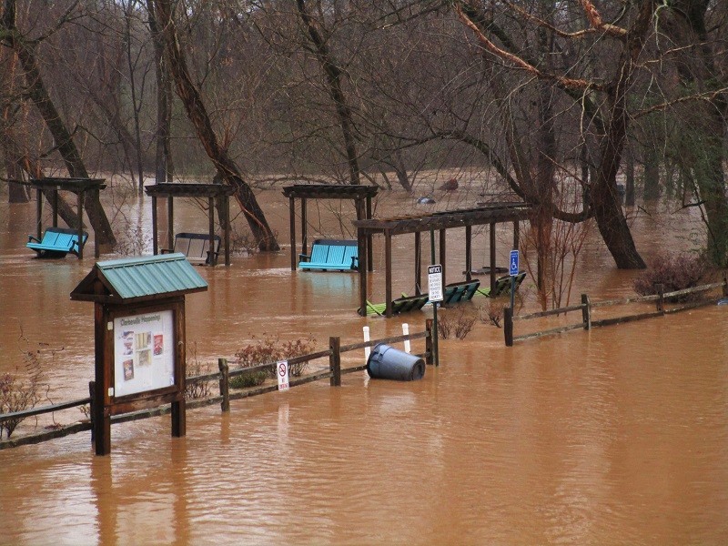
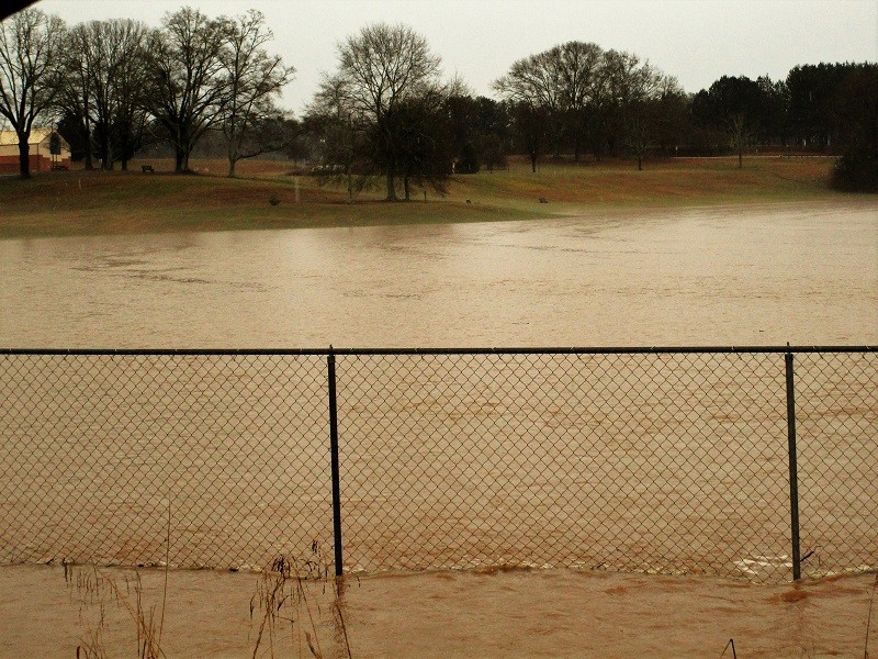
Water from the Soque River floods Pitts Park in Clarkesville.

The current from the Soque River pushes water across Pitts Park in Clarkesville just before noon Friday.
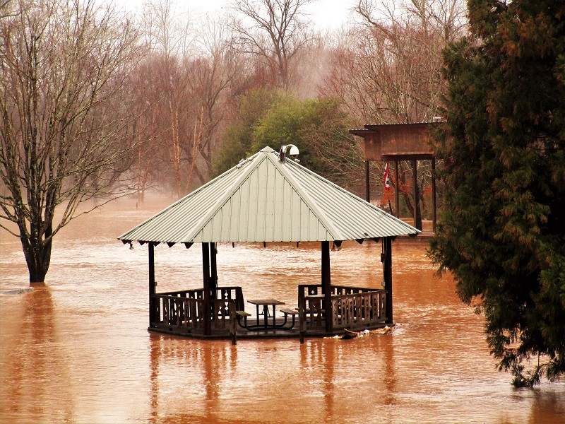
A trash can floats across the parking area at Pitts Park in Clarkesville after floodwaters from the Soque River overtook the park on Friday.
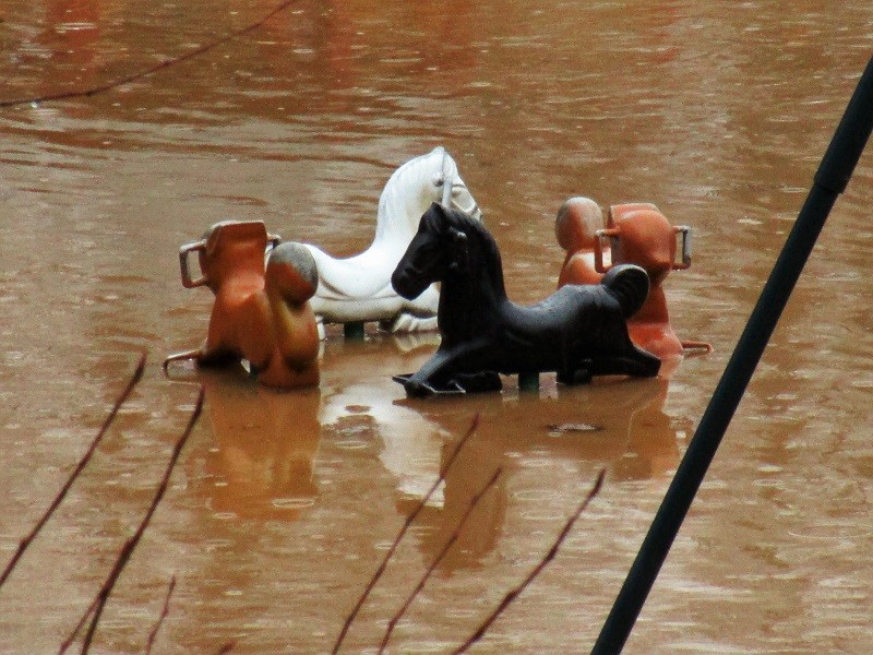
The children's horses at Pitts Park in Clarkesville tread water as flooding from the Soque River cover the grounds Friday.
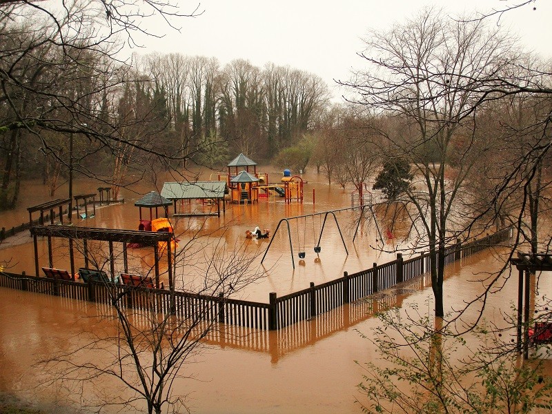
Water from the swollen Soque River cover the playground at Pitts Park in Clarkesville.
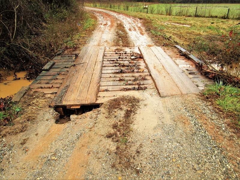
Floodwaters forced the closure of this bridge on Wall Bridge Loop north of Clarkesville on Friday after a washout.
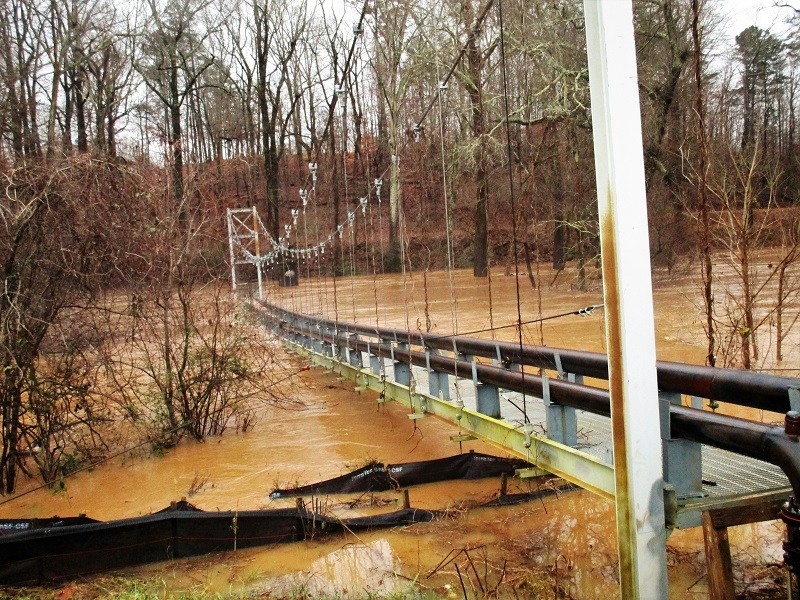
Rising water reaches the bottom of this utility bridge over the Soque River in Clarkesville on Friday.
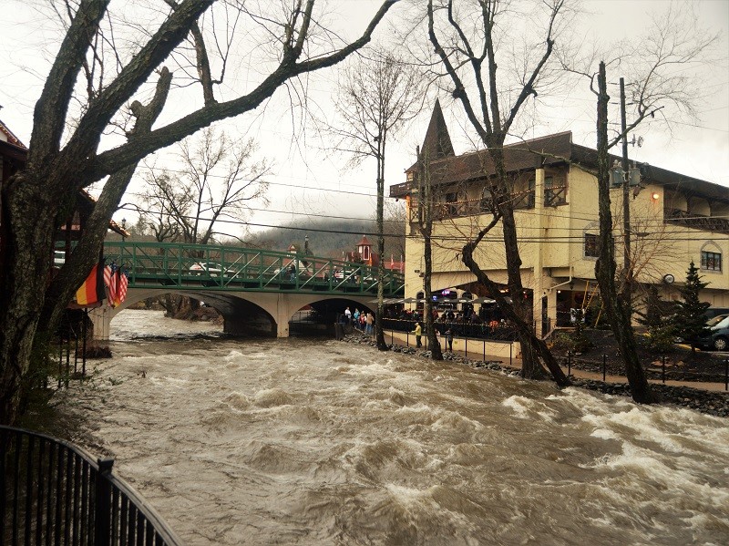
The rushing waters of the Chattahoochee River near downtown Helen recede to about 3.34 feet at 3 p.m. Friday after cresting at 4.02 feet at 8:45 a.m.
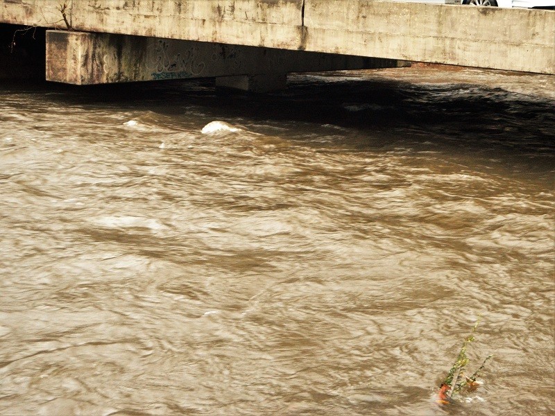
The water level of the Chattahoochee River begins to recede at the Edelweiss Strasse bridge near the Festhalle in Helen Friday afternoon.
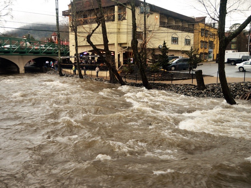
People gather on the Main Street pedestrian bridge and along the walkway near The Troll Tavern in downtown Helen to watch the rushing waters of the Chattahoochee River Friday.
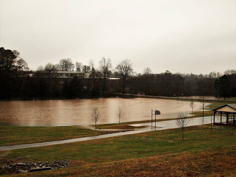
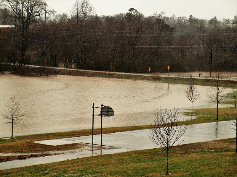
The lower ballfield at Clarkesville Elementary School near Beaver Dam Road resembles a lake due to floodwaters Friday.
Rising water approaches Beaver Dam Road in Clarkesville from both sides Friday morning.
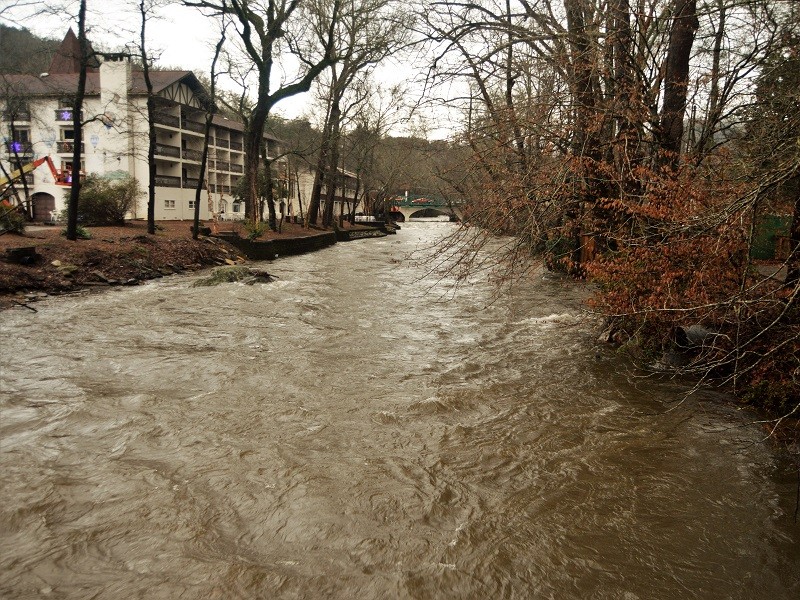
The rain-swollen Chattahoochee River begins to recede near the Helendorf in Helen on Friday.
The grounds of Clarkesville Elementary, top left, fill with floodwaters Friday morning.
http://accesswdun.com/article/2018/12/748053/photo-gallery-first-of-three-expected-storm-systems-floods-roads-parks-in-north-georgia
© Copyright 2015 AccessNorthGa.com
All rights reserved. This material may not be published, broadcast, rewritten, or redistributed without permission.