ST. MARYS, Ga.— Five manatees fitted with satellite transmitters mark the start of a project aimed at giving researchers a clearer picture of how these endangered mammals use the murky estuarine waters near the Kings Bay submarine base and along the rest of Georgia’s coast.
Wildlife agencies and organizations from Georgia and Florida teamed up last week to capture, outfit with GPS tracking devices and release the manatees back into Cumberland Sound.
The five are the first tagged in the multi-year effort to document manatee activity near Naval Submarine Base Kings Bay, map migratory paths and habitat use along the Southeastern coast, and provide baseline data to help assess manatee health. Project partners include the Naval Submarine Base Kings Bay, Georgia Department of Natural Resources, Georgia Aquarium, Sea to Shore Alliance and others.
Clay George, who leads marine mammal research for Georgia DNR’s Nongame Conservation Section, said this is the first time manatees have been tracked in the state using the highly accurate GPS tags.
“The tags will help us identify travel corridors and high-use habitats, both at Kings Bay and other places along the coast,” George said.
Federally listed as endangered, manatees migrate each spring from Florida to Georgia, attracted by abundant marsh grass and other aquatic vegetation. Manatees occur in all tidal waters throughout coastal Georgia from April through October.
These large, slow-moving animals swim just below the surface, often putting them in harm’s way of oncoming boats. Watercraft collisions caused 30 percent of the manatee mortalities documented in the state since 2000. The statistic highlights the need to better understand manatee movements in Georgia.
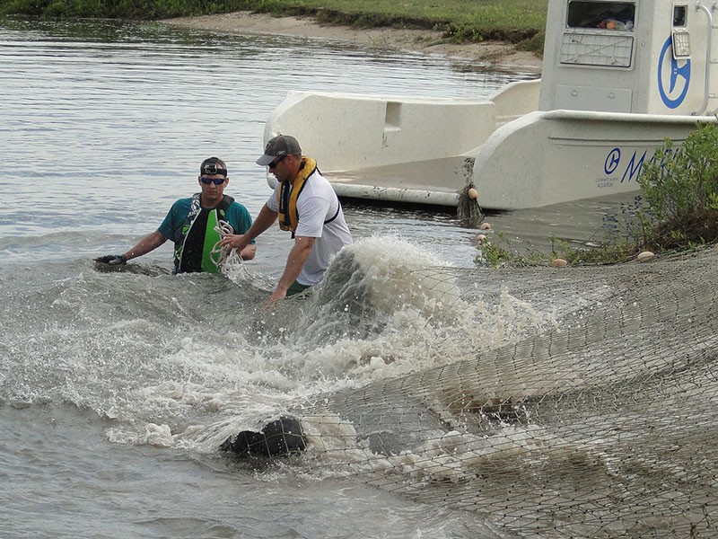
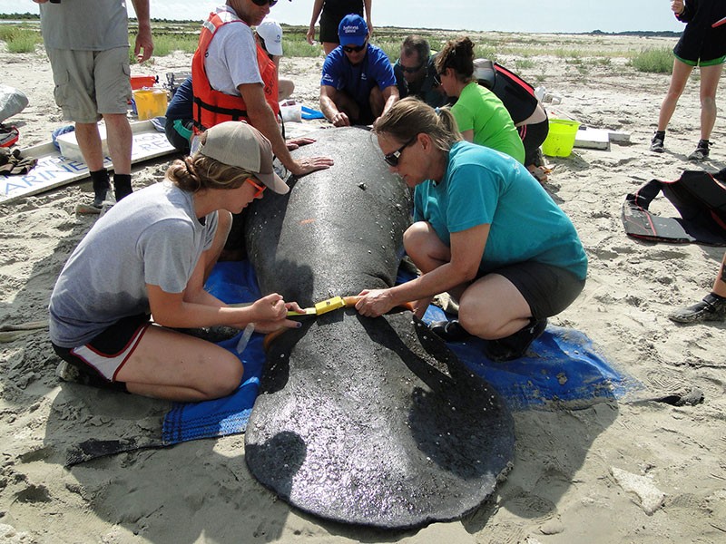
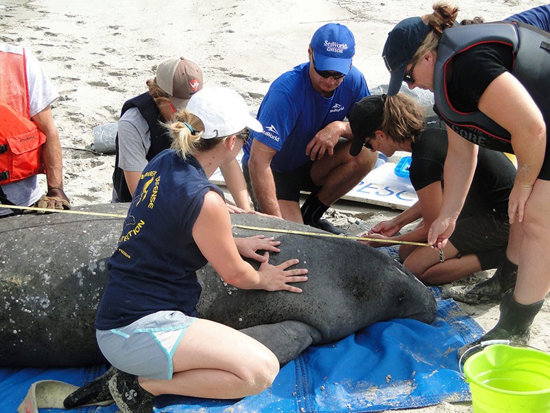
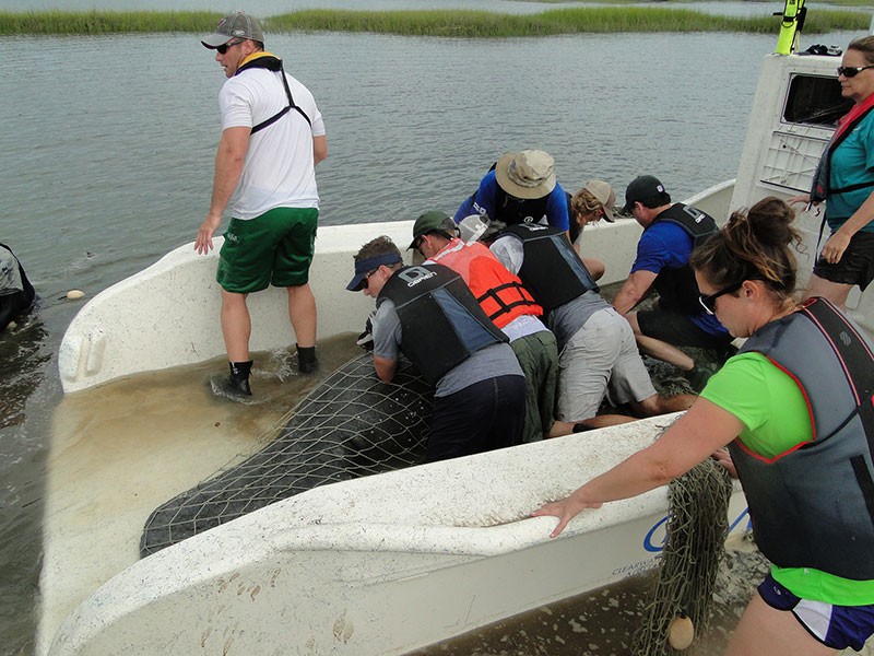
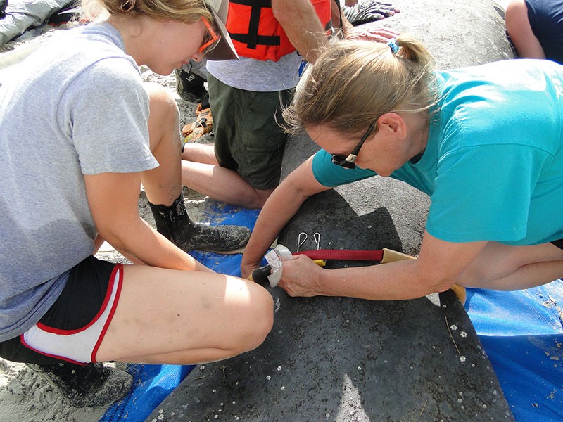
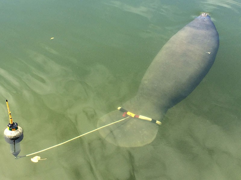
On June 3 and 4, the team used a DNR helicopter to spot manatees. Clearwater Marine Aquarium’s capture boat deployed a net to encircle the half-ton animals. Biologists and veterinary staff examined those caught – all adult males – took health samples, attached transmitters and released them unharmed. The transmitter, tethered to a belt around the tail, floats at the surface behind the manatee.
Monica Ross, research scientist with Sea to Shore Alliance, the lead contractor for the work, stressed that the tracking device does not impede the animal’s movement or pose a risk of entanglement. The belt, the tether linked to the transmitter and the tag itself are each designed to part easily, Ross said.
“Manatees have even given birth wearing these tags.”
Georgia Aquarium is helping with field operations and analyzing blood and other samples. “We are proud and excited to be a part of this project, which allows us to expand our Health and Environmental Risk Assessment programs,” said Dr. Gregory Bossart, Georgia Aquarium senior vice president and chief veterinary officer. “These studies allow us to look at dolphins and now manatees as sentinel species, which helps provide Georgia Aquarium and other researchers with valuable information about animal health, the overall health of the oceans they inhabit and how the oceans affect human health.”
Project funding has been provided by Commander, Navy Region Southeast; U.S. Fish and Wildlife Service; Georgia Aquarium; Georgia Nongame Wildlife Conservation Fund; and, Sea to Shore Alliance.
Staff from the National Park Service, Clearwater Marine Aquarium, U.S. Geological Survey, SeaWorld Orlando, U.S. Coast Guard, National Marine Mammal Foundation, Science Applications International Corp. (SAIC) and Crystal River National Wildlife Refuge also helped capture and tag the manatees.
The work last week underscored the project’s promise in two ways. First, the aerial team spotted about 40 manatees on Thursday morning, hinting at how many manatees migrate into Georgia from Florida each spring and summer. Also, four of the tagged manatees were tracked into restricted waters at the submarine base, and one was later seen near St. Simons Island. Researchers anticipate others will swim north along the coast, providing even more needed insights into manatee movements in Georgia.


http://accesswdun.com/article/2015/6/316578/manatees-tracked-to-explore-movements-on-georgia-coast