Planners with the Gainesville-Hall Metropolitan Planning Organization (GHMPO) are moving ahead with funding for a trail connection study for a trail winding its way through Buford, Flowery Branch and Oakwood as part of the larger Highlands to the Islands trail system.
The study, approved Tuesday by the GHMPO Policy Committee, costs $120,000, and serves as a means to "tie together all the work that's already been done," said Bill Andrew, Flowery Branch city manager.
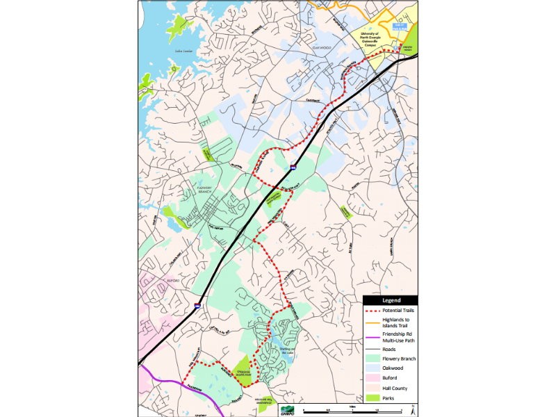
The proposed trail could connect Friendship Road and the University of North Georgia's Gainesville campus, according to GHMPO documents.
Initial plans, which are subject to change, call for the trail to head north along Hog Mountain Road starting at Friendship Road.
From there, the trail would wind its way over to Blackjack Road and into Cherokee Bluffs Park before heading north through the Sterling on the Lake subdivision.
Then it would pick up Spout Springs Road to Hog Mountain Road to Atlanta Highway to Thurmond Tanner Road, said Andrew.
It will connect to the Highlands to the Islands Trail at the University of North Georgia.
"The idea is that the Chicopee path that's already in place, it'll connect with Midtown in Gainesville ... Eventually you'll be able to ride all the way to (Lake Lanier) Islands or Braselton on Friendship Road," said Andrew.
Both the GHMPO Citizen's Advisory Committee and Technical Coordinating Committee approved the plan as well.
http://accesswdun.com/article/2017/8/568292/transportation-planners-approve-funding-for-south-hall-trail